Home :: Just Tassie Books :: Tasmap Tasmania South East 1:250 000 map

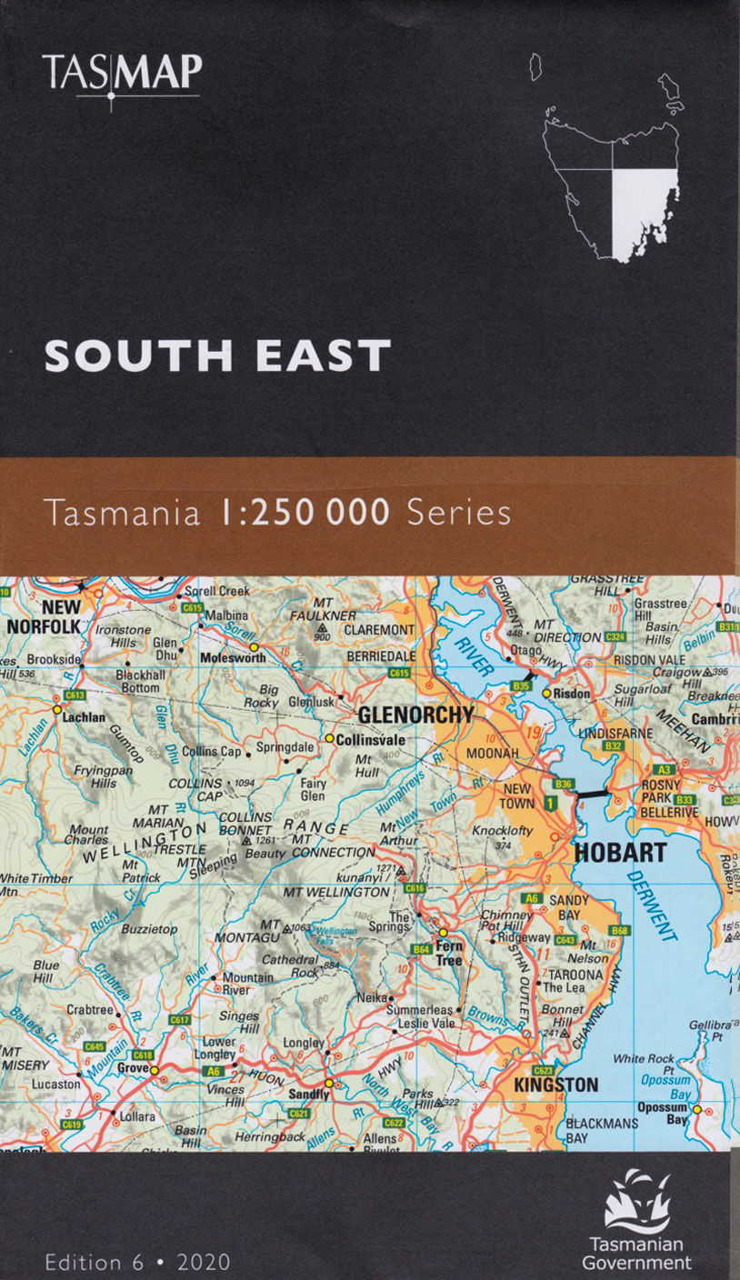
Tasmap Tasmania South East 1:250 000 map

Tasmap Tasmania South East 1:250 000 map
 
(0 reviews)  

This folded map of South Eastern Tasmania is one of a series of 4 maps covering all of Tasmania; the individual maps cover an area of approximately 37 000 square kilometres.

Roads are symbolised to reflect their surface and importance in the state network. The shape of the ground is depicted by a combination of contours (at 100m vertical interval), hypsometric tinting and hillshading. This series of maps is recommended for regional planners or visitors to Tasmania intending to travel off the common tourist routes.

Edition 6
Published: 2020
SKU SKU19000
Quantity in stock 2 item(s) available
Weight 0.17 kg
Author Tasmap
ISBN 9318923008432
 
Our price: AUD 9.96
including GST 10.00 % ( AUD 0.91 )
Click here to be notified of price drops of this item
 
Quantity (2 available)
Convict Lives at the George Town Female Factory Sail & Steam, Trading Vessels to Georges Bay 1833-1958 Historic Tasmanian Mountain Huts through the photographer's lens
AUD 25.00
AUD 49.95
AUD 55.00
 
A-Z of Endangered Animals Port Arthur 28th April 1996... and the aftermath, a personal account Tasmanian Plants Toxic for Animals
AUD 18.99
AUD 39.95
AUD 26.50
 
Early Tasmanian Bridges The Old Kirk and St. Andrew's Church, Launceston Anson, Hudson & Sunderland in Australian Service
AUD 32.00
AUD 22.50
AUD 35.00
There have been no reviews